

.jpg)
.jpg)
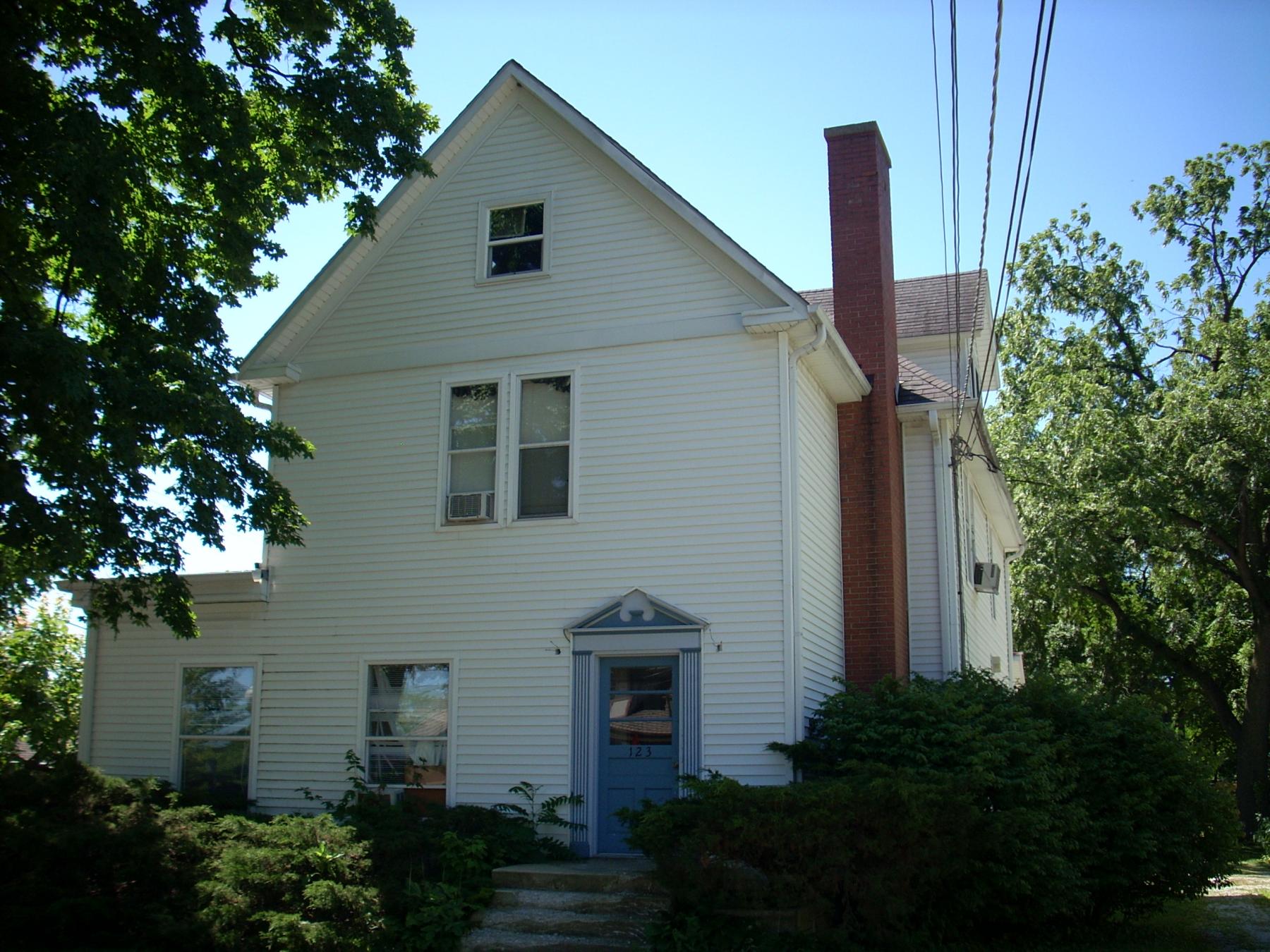
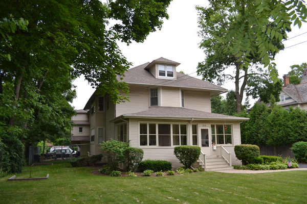
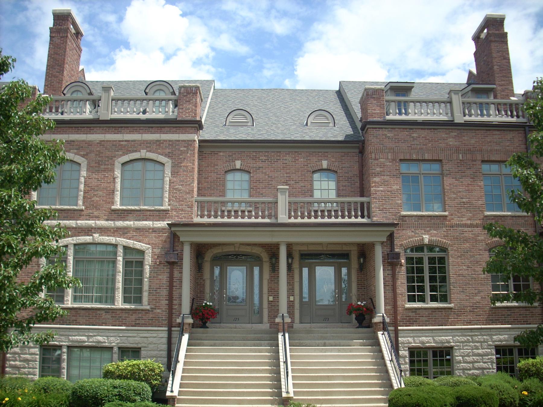
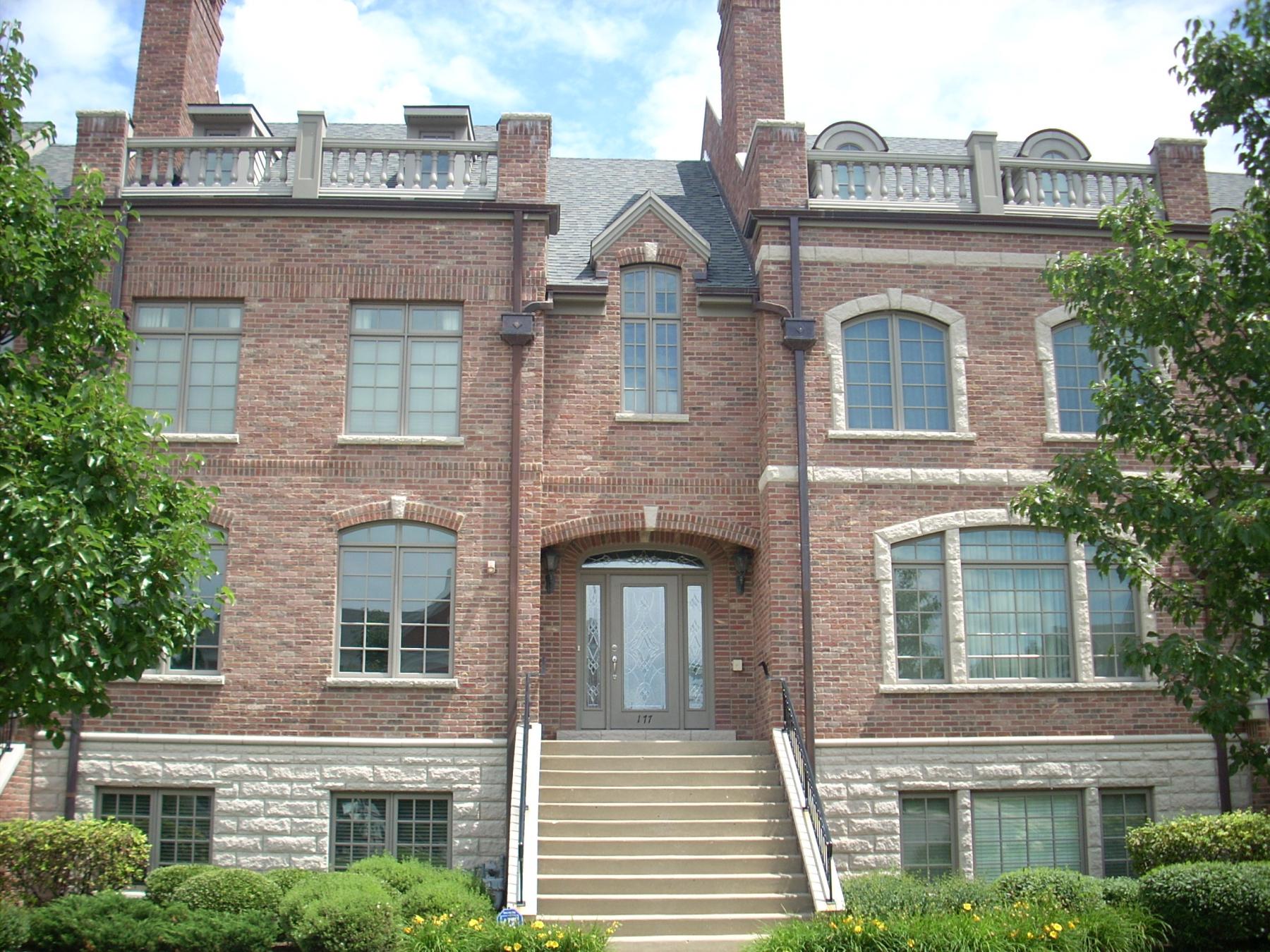
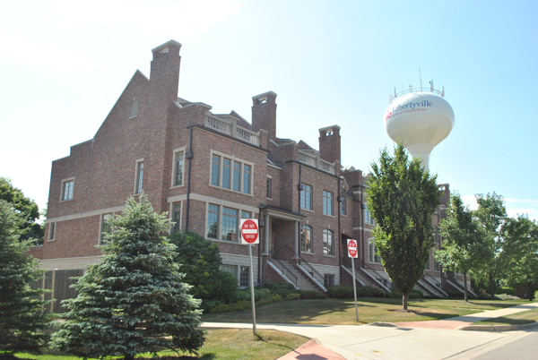
Building name:
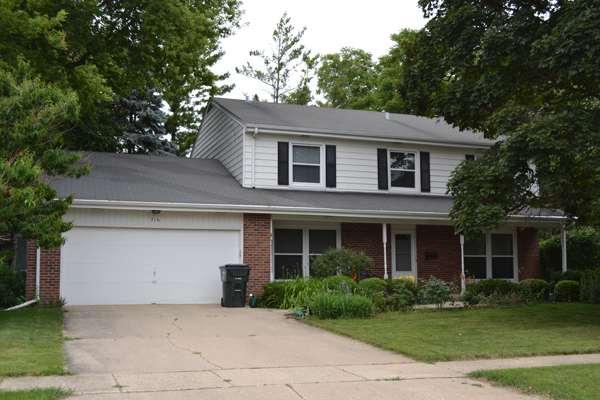
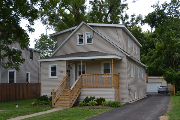
Ground Floor Use: Residential
Upper Floor Use: Residential
Current Occupant: Residential
Zoning: R-7
Number of Stories: 2
Property Index Number: 1121203012
Within Local District?: No
Local Dist Contrib/Non-Contrib?: NC
Local Landmark?: No
Year: No
Local Landmark Eligible?: No
Criteria: No
NR District Contrib/Non-Contrib: NC
Within District?: No
NR Landmark?: No
Year: No
NR Eligible?: No
Criteria: No
Alternate Address?: No
Category: Building
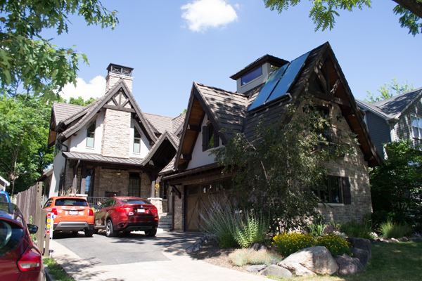
Condition: Good
Integrity: Major alterations and additions
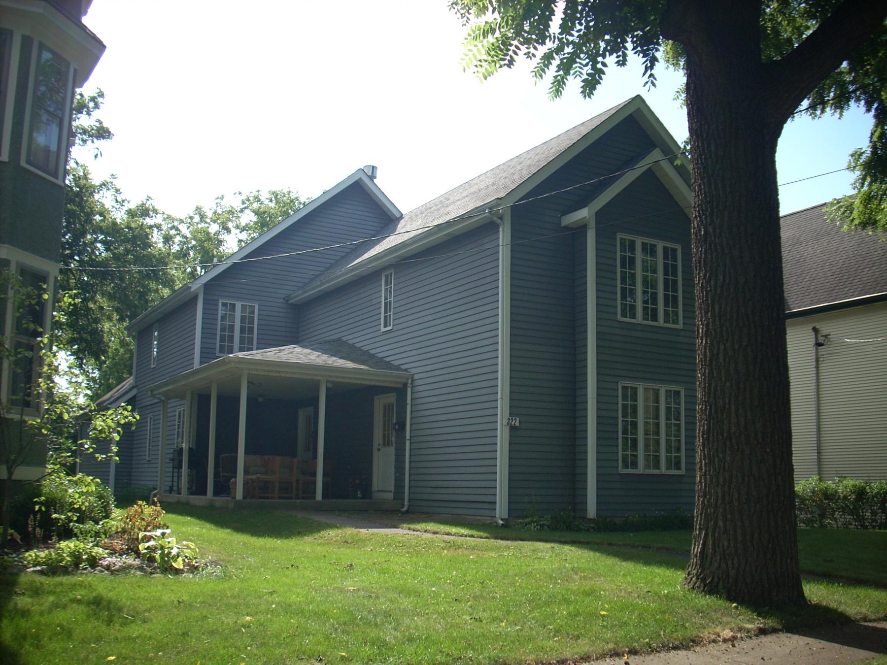
Current Use: Domestic - single dwelling
Historic Use: Domestic - single dwelling
Secondary Structure: Detached garage
NR Second: C
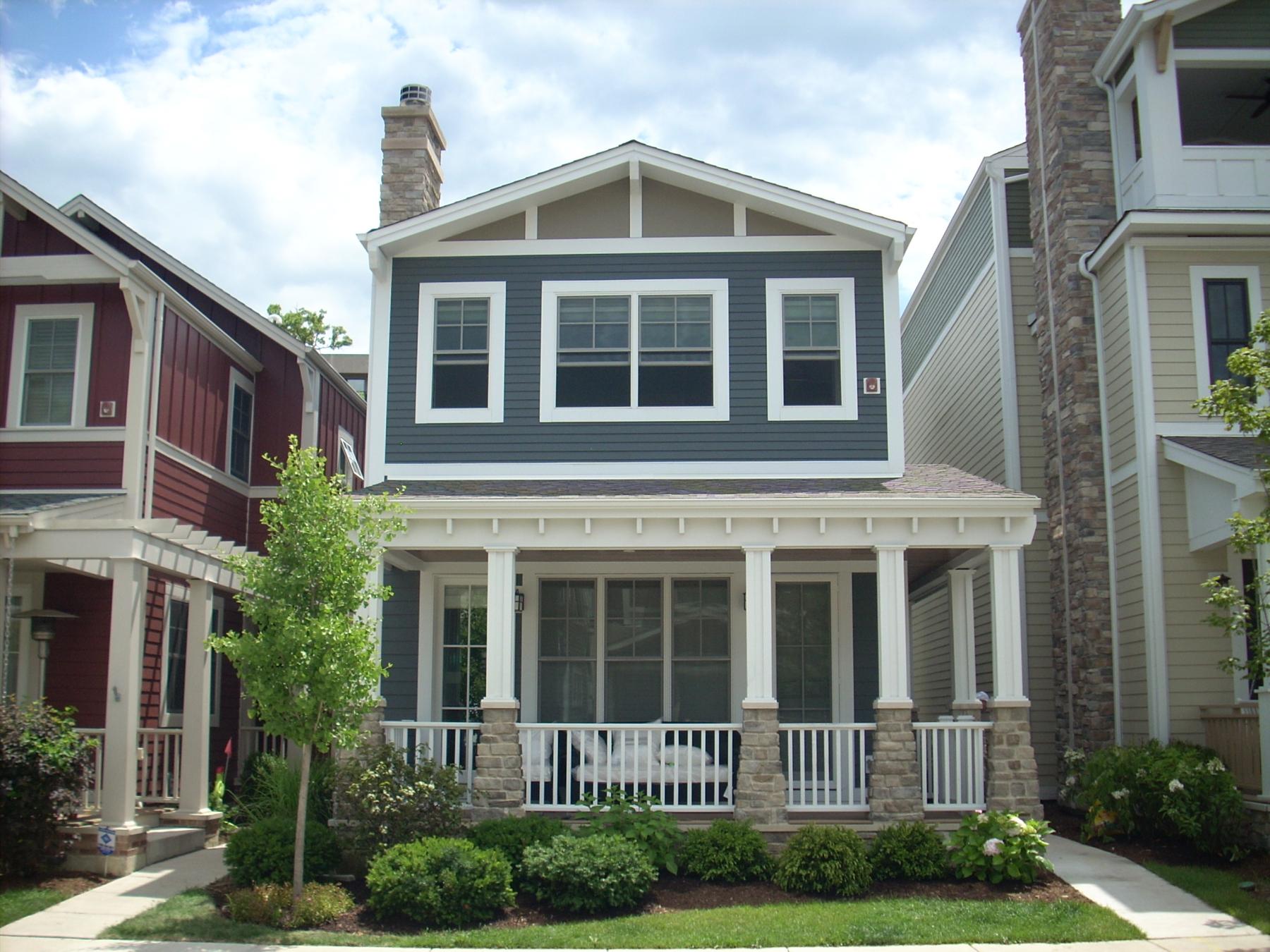
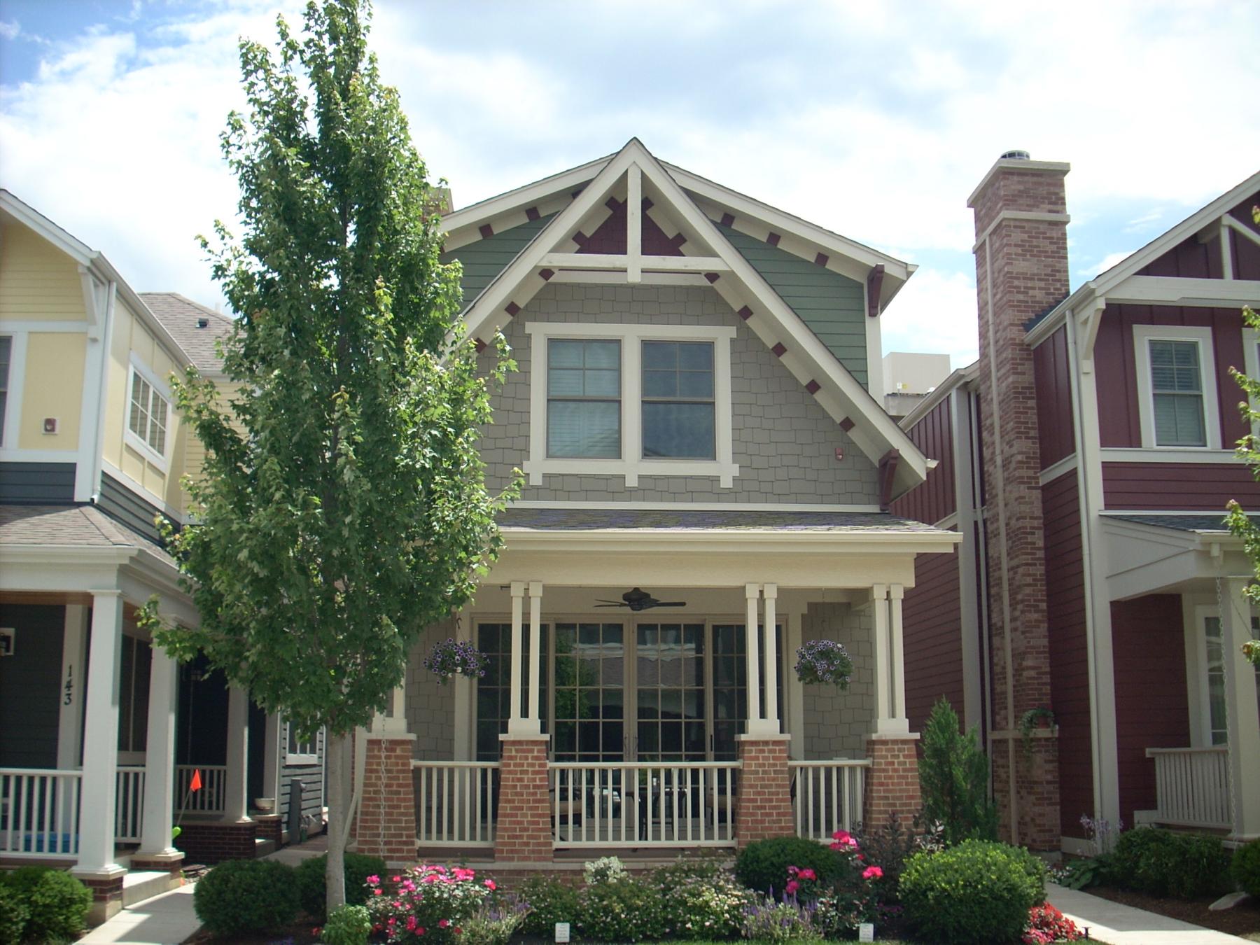
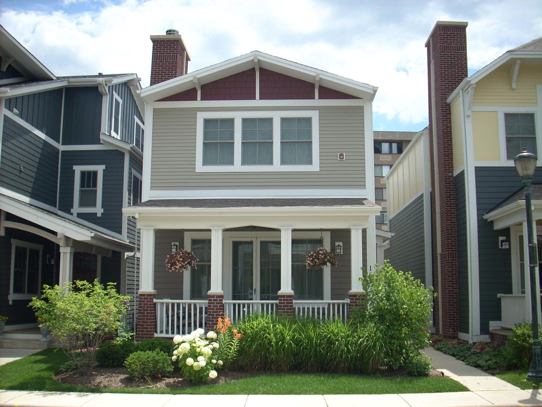
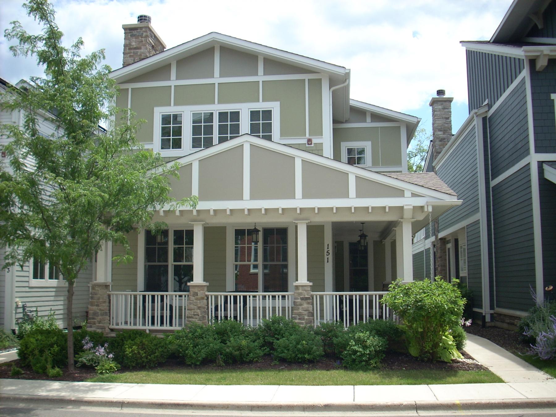
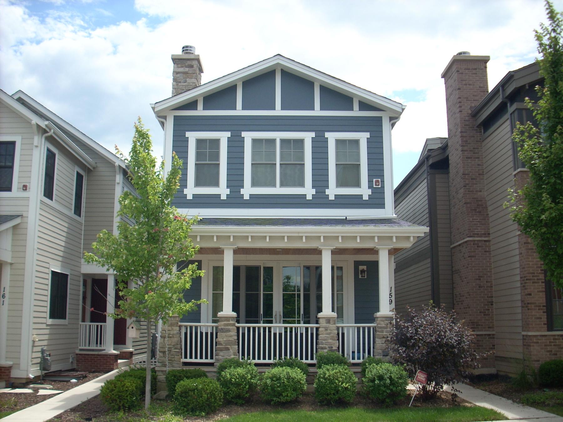
Architectural Classification: Gable Front
Details: Craftsman
Other Year: 1920 (c); 1997
Date source: Assessor/Surveyor/permit
Wall Material (Current): Wood - shingles
Wall Material 2 (Current): Wood
Plan: Rectangular
No of Stories: 2
Roof Type: Front Gable
Roof Material: Asphalt - shingle
Foundation: Not visible
Porch: Front entry
Window Material: Wood
Window Material 2: Wood
Window Type: Combination
Window Configuration: Combination
Significance: Combination
Historic Features: Front gable roof; hipped roof full-front porch structure (partially enclosed c. 1920); historic (but not original) 3/1 double hung windows on front facade
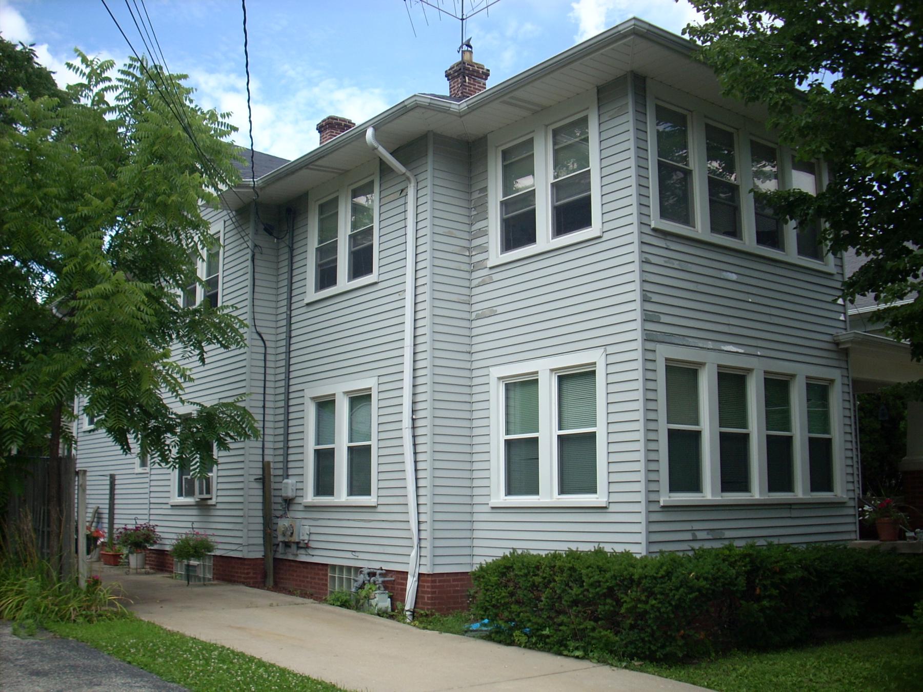
Alterations: Large 2-story rear addition that is taller than original house (1997); wood shingles on front facade (1951); front porch partially enclosed c. 1920; entry porch steps and railing are more recent
Old Address (city dir.year: Large 2-story rear addition that is taller than original house (1997); wood shingles on front facade (1951); front porch partially enclosed c. 1920; entry porch steps and railing are more recent
Building Moved?: Large 2-story rear addition that is taller than original house (1997); wood shingles on front facade (1951); front porch partially enclosed c. 1920; entry porch steps and railing are more recent
Moved From: Large 2-story rear addition that is taller than original house (1997); wood shingles on front facade (1951); front porch partially enclosed c. 1920; entry porch steps and railing are more recent
Original Owner: Whitney, Lew
Original Architect: Whitney, Lew
Architect Source: Whitney, Lew
Builder: Whitney, Lew
Surveyor: LR
Surveyor Organization: Ramsey Historic Consultants
Survey Date: May-June 2016
Survey Area: Downtown Libertyville
Old Address: Downtown Libertyville
Date of Construction: Downtown Libertyville
Moving Permit #: Downtown Libertyville
Date Moved: Downtown Libertyville
Building Permit #: Downtown Libertyville
Date: Downtown Libertyville
Building Permit Description: Downtown Libertyville
Cost: Downtown Libertyville
Original Owner Occupied?: Downtown Libertyville
Exterior Alteration Permits: 97-524 (7/11/1997)--rear addition ($50,000); No Permit # (11/2/1951)--reside house with John manvills Shingles
Other Permit Information: 00-974 (2001)--addition to garage
COA Info: 00-974 (2001)--addition to garage
Historic Info: Historic image of photograph on Illinois Digital Archives (in collection of Libertyville Mundelein Historical Society and Cook Memorial Public Library: http://www.idaillinois.org/cdm/singleitem/collection/cookmemo11/id/6501/rec/5 Back of photograph reads "House of Lew Whitney." According to Illinois Digital Archives, Whitney was a tinner.
Other Sources: Sanborn maps, 1933, 1948
Historic Info Compiler: LR
Volunteer: LR
 Contributing
 Non-contributing
.jpg)
.jpg)
.jpg)
.jpg)
.jpg)
.jpg)
.jpg)
.jpg)
.jpg)
.jpg)
.jpg)
.jpg)
.jpg)
.jpg)
.jpg)
.jpg)
.jpg)
.jpg)
.jpg)
.jpg)
.jpg)
.jpg)
.jpg)
.jpg)
.jpg)
.jpg)
.jpg)
.jpg)
.jpg)
.jpg)
.jpg)
.jpg)
.jpg)
.jpg)
.jpg)
.jpg)
.jpg)
.jpg)
.jpg)
.jpg)
.jpg)
.jpg)
.jpg)
.jpg)
.jpg)
.jpg)
.jpg)
.jpg)
.jpg)
.jpg)
.jpg)
.jpg)
.jpg)
.jpg)
.jpg)
.jpg)
.jpg)
.jpg)
.jpg)
.jpg)
.jpg)
.jpg)
.jpg)
.jpg)
.jpg)
.jpg)
.jpg)
.jpg)
.jpg)
.jpg)
.jpg)
.jpg)
.jpg)
.jpg)
.jpg)
.jpg)
.jpg)
.jpg)
.jpg)
.jpg)
.jpg)
.jpg)
.jpg)
.jpg)
.jpg)
.jpg)
.jpg)
.jpg)
.jpg)
.jpg)
.jpg)
.jpg)
.jpg)
.jpg)
.jpg)
.jpg)
.jpg)
.jpg)
.jpg)
.jpg)
.jpg)
.jpg)
.jpg)
.jpg)
.jpg)

.jpg)
.jpg)
.jpg)
.jpg)
.jpg)
.jpg)
.jpg)
.jpg)
.jpg)
.jpg)
.jpg)
.jpg)
.jpg)
.jpg)
.jpg)
.jpg)
.jpg)
.jpg)
.jpg)
.jpg)
.jpg)
.jpg)
.jpg)
.jpg)
.jpg)
.jpg)
.jpg)
.jpg)
.jpg)
.jpg)
.jpg)
.jpg)
.jpg)
.jpg)
.jpg)
.jpg)
.jpg)
.jpg)
.jpg)
.jpg)
.jpg)
.jpg)
.jpg)
.jpg)
.jpg)
.jpg)
.jpg)
.jpg)
.jpg)
(3).jpg)
(1).jpg)
.jpg)
.jpg)
.jpg)
.jpg)
.jpg)
.jpg)
.jpg)
.jpg)
.jpg)
.jpg)
.jpg)
.jpg)
.jpg)
.jpg)
.jpg)
.jpg)
.jpg)
.jpg)
.jpg)
.jpg)
.jpg)
.jpg)
.jpg)
.jpg)
.jpg)
.jpg)
.jpg)
.jpg)
.jpg)
.jpg)
.jpg)
.jpg)
.jpg)
.jpg)
.jpg)
.jpg)
.jpg)
.jpg)
.jpg)
.jpg)
.jpg)
.jpg)
.jpg)
.jpg)
.jpg)
.jpg)
.jpg)
.jpg)
.jpg)
.jpg)
.jpg)
.jpg)

.jpg)
.jpg)
.jpg)
.jpg)
.jpg)
.jpg)
.jpg)
.jpg)
.jpg)
.jpg)
.jpg)
.jpg)
.jpg)
.jpg)
.jpg)
.jpg)
.jpg)
.jpg)
.jpg)
.jpg)
.jpg)
.jpg)
.jpg)
.jpg)

.jpg)

.jpg)
.jpg)
.jpg)
.jpg)
.jpg)
.jpg)
.jpg)
.jpg)
.jpg)
.jpg)
.jpg)
.jpg)